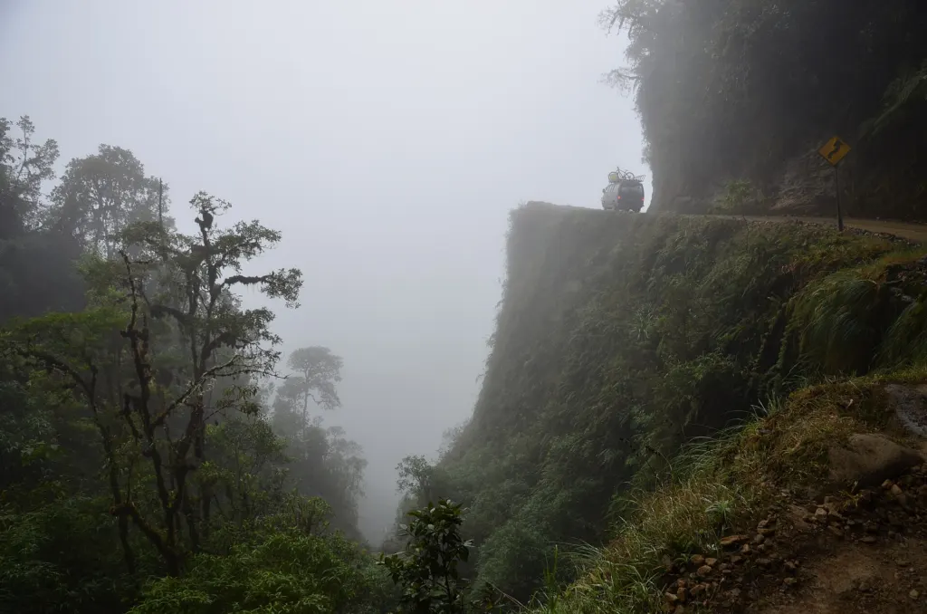
Bolivia’s Yungas Road drops about 3,500 meters (11,500 feet) in 64 kilometers (40 miles), on a track that is less than 3 meters wide in places. It was once called the most dangerous road in the world. Today about 25,000 tourists a year go looking for it on purpose, most of them on mountain bikes.
Locals and visitors know it simply as the Death Road, or Camino de la Muerte. It links La Paz with the Yungas, the warm, forested valleys that fall away toward the Amazon.
Built by prisoners of war
The Bolivian government built the road in the 1930s, and much of the work was done by Paraguayan prisoners captured in the Chaco War between the two countries. For decades it was one of the few routes connecting the northern jungle with La Paz, and until 2006 it was the only way to drive between the town of Coroico and the capital.
The setting made it lethal. Steep slopes and sheer drops sat beside a single lane with no guardrails. Rain and fog cut visibility, while mud, loose stones, landslides and waterfalls spilling over the track made it hard to keep traction.
One odd rule survives from that era. Unlike the rest of Bolivia, traffic on the Yungas Road keeps to the left. The reason was practical: driving on the left let drivers judge more easily how close their vehicles were to the edge of the road.
How dangerous it was
Estimates of the toll vary. One count puts the old road at an average of about 209 crashes and 96 deaths a year; other figures put the deaths at 200 to 300 a year before the new highway opened. In 1995 the Inter-American Development Bank gave it the label that stuck: the most dangerous road in the world.
The fix took about 20 years. A new two-lane route, now part of Bolivia’s Route 3, was finished in 2006 with asphalt paving, bridges, drainage, guardrails and a new section between Chusquipata and Yolosa that bypasses the worst stretches of the old track.
From truck route to bike ride
With the trucks and buses gone, the old North Yungas Road is now used mainly by cyclists, motorcyclists and hikers, and the descent has become a popular adventure-tourism ride, especially for mountain bikers.
The descent, in numbers:
- Length: 64 km (40 miles), linking La Paz with the Yungas region near Coroico.
- Drop: about 3,500 m (11,500 ft), or roughly 55 meters lost for every kilometer ridden, an average gradient near 5.5% (3,500 ÷ 64,000).
- Width: under 3 m (9.8 ft) on several sections.
- Visitors: about 25,000 a year, or close to 70 riders a day on average (25,000 ÷ 365).
The ride ends in subtropical country. Coroico sits at about 1,525 meters (5,003 feet), the capital of Nor Yungas Province since 1899 and a market town for fruit, wood and coca. The town keeps the Feast of the Virgin every October 20, remembering how its 500 residents held off a much larger siege during the Bolivian War of Independence.
Other extreme journeys
The Death Road belongs to a small club of trips that are famous because they are hard. Bhutan’s runway is another: Paro airport sits in a valley ringed by 18,000-foot peaks, and only a few pilots are cleared to land there. In India, hikers queue for Kalavantin Durg, a 686-meter rock spire climbed on steps cut into the cliff.
The road that once carried most of the traffic between La Paz and the Yungas now carries mostly bikes, about 70 of them on an average day.
Further reading
Image: Pavel Špindler, CC BY 3.0 via Wikimedia Commons
This article was produced with AI assistance and reviewed by our Editorial Desk. How we work.