Every so often someone steps outside, looks up and sees a corridor: long, straight bands of cloud running overhead and narrowing toward the horizon like the walls and ceiling of a hallway. A photo of exactly that kind of sky, taken outside a Reddit user’s apartment, drew a crowd on the site this week. The scene looks staged, but two very ordinary things explain it: cloud streets and linear perspective.
Part one: the clouds really are in rows
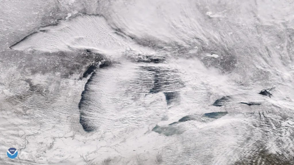
Meteorologists call the long parallel lines cloud streets, or horizontal convective rolls. Near the ground, air can organize itself into long, counter-rotating tubes that lie almost flat and line up with the wind. Where two tubes spin upward together, moist air rises, cools and condenses into a line of puffy cumulus. Where they spin downward, the air sinks, warms and the cloud evaporates, leaving a clear lane.
NASA’s Earth Observatory described the same machinery when cloud streets formed over the Laptev Sea north of Siberia in July 2025: warm open water fed rising thermals until they hit a temperature inversion that works like a lid, forcing the air to roll over into parallel spinning cylinders, cloudy on the rising side and clear on the sinking side.
The result is stripes: cloud, gap, cloud, gap. The rolls usually fill the lowest layer of the atmosphere, about 1 to 2 kilometers deep, and each pair is roughly three times as wide as it is tall. They can last for hours, sometimes days.
The recipe is fairly specific:
- an unstable layer of air near the ground, warmed from below
- a lid of stable air above it, called an inversion
- a moderate, steady wind to stretch the convection into lines
With weak winds, the same convection breaks into scattered cells instead of rows. Glider pilots love cloud streets because the rising air under each line lets them fly straight for long distances, which is where the name comes from.
Part two: parallel lines meet at the horizon
The hallway effect is the same illusion that makes railroad tracks seem to touch in the distance. The rows are essentially parallel, but the farther away a section is, the smaller it looks, so every line appears to converge on a single vanishing point near the horizon. Overhead, the rows look wide and well spaced; far off, they squeeze together into a point.
A quick calculation shows how strong the squeeze is. Take a band of cloud 1 kilometer wide at a height of 2 kilometers. Directly overhead it is 2 kilometers away, so it spans about 1 divided by 2, or 0.5 radians, roughly 29 degrees of sky. The same band 20 kilometers away spans about 1 divided by 20, or 0.05 radians, just under 3 degrees. Same cloud, ten times smaller, and the eye reads that as a tunnel.
Light can build the hallway too
A close cousin of the effect involves sunbeams. At dawn or dusk, shafts of light and shadow passing between clouds can stretch across the whole sky. On the side of the sky facing away from a low sun they are called anticrepuscular rays, and although the rays are essentially parallel, perspective makes them seem to meet at the antisolar point, the spot directly across the sky from a low sun. They are dimmer than the ordinary sunbeams on the sunward side, because less light scatters backward than forward.
If a hallway sky has bright and dark stripes and appears near sunset, rays may be part of it. If it shows puffy white rows in the middle of the day, cloud streets are the likelier answer.
We have covered other odd skies, from noctilucent clouds that form about 50 miles up to the Northern Taurid fireballs. To spot cloud streets yourself, look for a cool morning after a clear night with a steady breeze, and face along the wind, not across it.
Further reading
Image: NOAA, Public domain via Wikimedia Commons
This article was produced with AI assistance and reviewed by our Editorial Desk. How we work.