Benjamin Banneker spent about three months in early 1791 helping lay out the 10-mile square that became the District of Columbia, and a sandstone marker from that survey, cut with the year 1791, still stands behind an iron fence in Arlington, Virginia. Born free in Baltimore County, Maryland, on November 9, 1731, the self-taught astronomer would have turned 295 this week.
Badiyaa has already covered the almanac Banneker sent Thomas Jefferson in 1791 and the letter in which he accused Jefferson of “that most criminal act” over slavery. This piece is about the ground he measured, and how much of that story can be pinned down.
How a farmer joined the capital survey
Early in 1791, Secretary of State Thomas Jefferson asked surveyor Maj. Andrew Ellicott to mark out a new federal district on land along the Potomac River given up by Maryland and Virginia. In February, Ellicott took Banneker on as an assistant and advanced him $60 for travel to Georgetown.
The US Park Service says Ellicott first asked his cousin George, a Quaker neighbor who had lent Banneker astronomy books and instruments. George declined and recommended his friend instead. Banneker left his 100-acre farm in the Patapsco Valley for the job.
What the record shows, and what it does not
The square was 10 miles on each side, 100 square miles in all, and the team set a boundary stone at or near every mile along its edge. Biographers have said Banneker made the star observations and calculations that fixed the starting point at Jones Point in Alexandria, Virginia, keeping a clock to match ground positions to the stars.
The paperwork is thinner than the legend. A report of the April 15, 1791, ceremony for the first stone, the south corner, credited Ellicott with fixing the starting point and did not mention Banneker. He left in April. The Park Service attributes his departure to health problems; his main biography points instead to his almanac calculations for 1792 and spring work on the farm. Ellicott’s brothers then joined, and the survey was finished in 1792.
Some popular retellings go further, saying Banneker laid out the city itself alongside the planner Pierre Charles L’Enfant, or rebuilt L’Enfant’s plan from memory. Historians treat those tales as part of a mythology that grew up after his death. Even the Park Service’s own landmark page describes him surveying “with Major Pierre Charles L’Enfant”, and dates his death to October 9, 1806. His biography records October 19 and notes that October 9 that year fell on a Thursday, not the Sunday some accounts claim.
Jefferson’s word in 1791
The strongest contemporary evidence comes from Jefferson. On August 30, 1791, he wrote to the French mathematician the Marquis de Condorcet that Banneker was “a very respectable mathematician” and that “I procured him to be employed under one of our chief directors in laying out the new federal city on the Patowmac”. By 1809, writing privately to Joel Barlow, Jefferson had grown dismissive, suggesting Ellicott had helped with the almanacs.
Where to see the stones
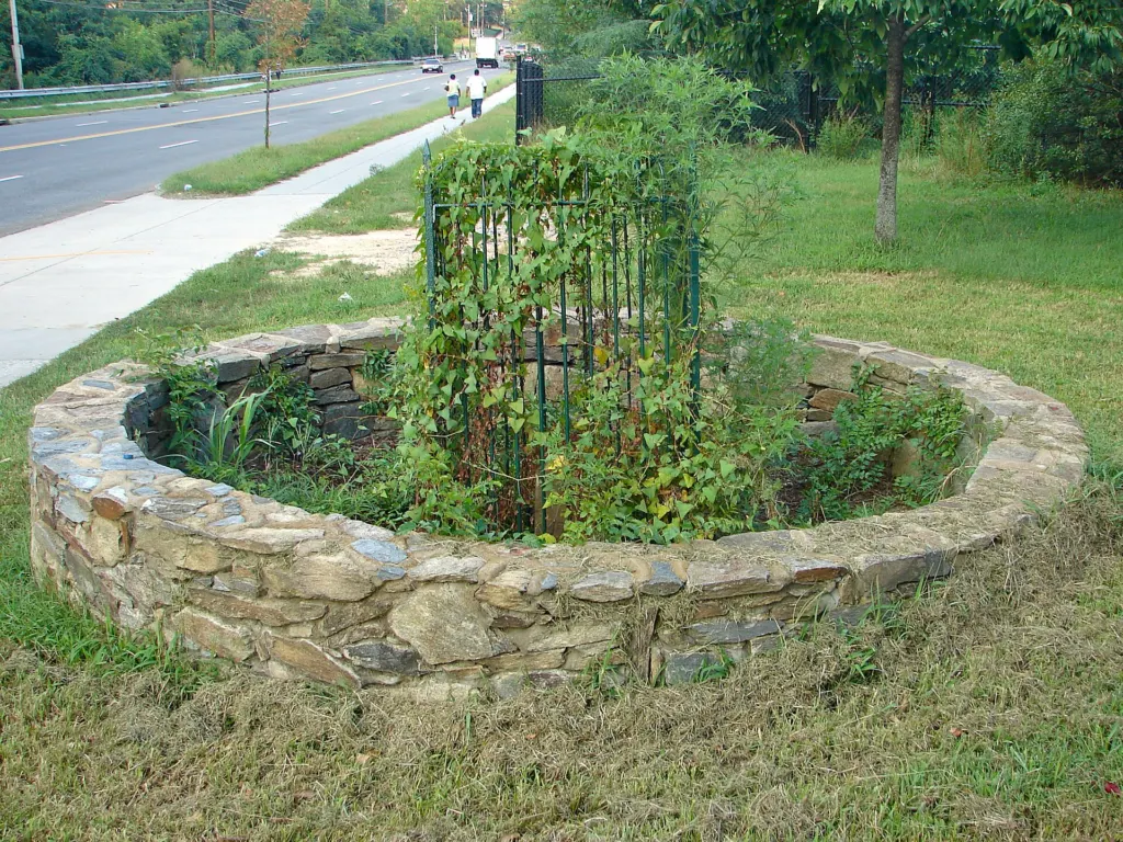
The SW-9 intermediate stone in Arlington is about 15 inches tall and one foot square. Its east face reads “Virginia” and its north face “1791”. It is a National Historic Landmark, and other surviving stones ring the old diamond-shaped boundary in Virginia, Maryland and the District. Banneker’s own papers mostly burned when his cabin caught fire on the day of his funeral, so these markers are among the few objects tied to his work that survive in place.
A 1977 obelisk near his unmarked grave stands in the churchyard of Mount Gilboa African Methodist Episcopal Church in Oella, Maryland, a short walk from the Benjamin Banneker Historical Park and Museum, which opened in 1998.
Further reading
- Wikipedia: Benjamin Banneker
- National Park Service: Benjamin Banneker and the Boundary Stones of the District of Columbia
Image: Smallbones, CC0 via Wikimedia Commons
This article was produced with AI assistance and reviewed by our Editorial Desk. How we work.