Nine people. That is the whole population of Kentucky Bend, a 17.5-square-mile pocket of Kentucky that does not touch the rest of Kentucky anywhere, according to the 2020 US census.
A post on Reddit’s Today I Learned forum on November 5 described a corner of the state that can be reached only through Tennessee or by crossing the Mississippi River from Missouri. The claim holds up, and the full story is stranger than a one-line post has room for.
A piece of Kentucky with no road to Kentucky
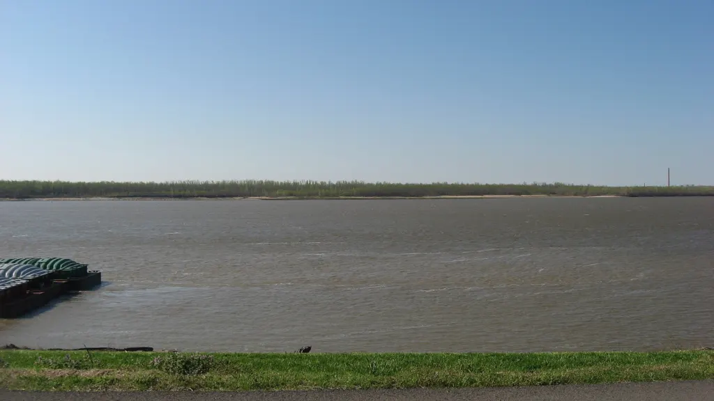
Kentucky Bend sits at the far southwestern tip of the state, inside a tight loop of the Mississippi. The river wraps around it to the west, north and east, with Missouri on the opposite bank. Its only land border, to the south, is with Tennessee.
One highway goes in: Tennessee State Route 22. Mail is addressed to Tiptonville, Tennessee. The Missouri town of New Madrid lies straight across the water to the north, yet no bridge or ferry joins the two. The nearest river crossings are the Dorena–Hickman Ferry and the Caruthersville Bridge.
For anyone living there, a drive to the county seat at Hickman starts by leaving Kentucky.
A straight line meets a crooked river
The Kentucky–Tennessee boundary descends from the Royal Colonial Boundary of 1665, drawn to separate the inland claims of colonial Virginia and Carolina long before either state existed. Kentucky’s western edge, meanwhile, is the Mississippi itself.
The surveyors who marked the line had only estimated where it would strike the river. Later, more careful surveys showed it slicing across a north–south loop, so the line hits the Mississippi, runs over a peninsula and hits the river a second time. The land above the line and inside the loop stayed with Kentucky. Missouri’s border is the river as well, which left Kentucky with a notch and Tennessee without one.
Tennessee did not give up quickly. It is said to have run the Bend as part of its own Obion County until at least 1848 before dropping the claim.
What the earthquakes did and did not do
Many retellings say an earthquake created the Bend, usually quoting a magnitude of 8.0. The record is more tangled. The New Madrid earthquakes of December 1811 to February 1812 rank as the most powerful on record east of the Rockies in the lower 48 states, and the US Geological Survey catalog lists the main shocks at magnitude 7.0 to 7.5.
The shock of February 7, 1812 lifted part of a fault beneath the river, throwing up temporary waterfalls on the Mississippi at Kentucky Bend and sending waves upstream. Eliza Bryan, who lived in New Madrid, wrote in March 1812 that the river’s current “was retrograde for a few minutes.” Some accounts add that the upheaval shifted the channel and confounded the boundary surveyors, who had not yet reached the river.
Cotton, gunboats and Mark Twain
Floodplain soil turned the Bend into rich cotton country. The 1870 census counted 308 people there, and the 1880 count reached 332.
War came first. From February 28 to April 8, 1862, Union and Confederate forces fought the Battle of Island Number Ten on this stretch of river.
Mark Twain steamed past years later and set down a local man’s account of a feud between the Darnell and Watson families in Life on the Mississippi. Both clans, the man told him, worshipped at one church at a landing called Compromise: “Half the church and half the aisle was in Kentucky, the other half in Tennessee.” The quarrel began over a horse or a cow, he said, and it “cost sixty years of killing and crippling.”
The arithmetic of an emptying place
The census trail shows how thoroughly the Bend has emptied: 308 residents in 1870, 21 in 2000, 18 in 2010 and nine in 2020. From 308 to nine is a drop of 299 people, or 97 percent (299 ÷ 308 = 0.971). Spread over 17.5 square miles of land, nine residents works out to roughly one person for every 1.9 square miles (17.5 ÷ 9 = 1.94).
Twain drew the map in a single sentence. “In this region,” he wrote, “the river passes from Kentucky into Tennessee, back into Missouri, then back into Kentucky, and thence into Tennessee again.”
Further reading
- Wikipedia: Kentucky Bend
- Wikipedia: 1811–1812 New Madrid earthquakes
- Wikisource: Life on the Mississippi, Chapter 26
Image: Nyttend, Public domain via Wikimedia Commons
This article was produced with AI assistance and reviewed by our Editorial Desk. How we work.